

The complexity of road weather
As mentioned in the previous blog post comparing static road weather stations with hyperlocal mobile measurements, road weather can be quite complex. It is extremely local and depends on a variety of factors. For example, the effect of winter weather on road conditions is influenced by factors such as dew point, temperature, cloudiness, road pavement type, road thermal capacity and traffic density.
These are all extremely local in nature. We can have water that is below the freezing point on the roads due to applied salt or brine, while the bridge on the same stretch of road can be covered in ice. However, in this blogpost we will focus on the freezing rain phenomena: why it occurs and why it’s so hard to predict.
Freezing rain, but how?
Icy roads requires freezing temperatures (somewhere in the process) and moisture to take place. The combination can occur in several ways, but arguably, the most frequent reason to icy roads occurs when road surface temperatures see-saw around the freezing point. Falling below freezing point during night and getting warm again during the day for example. With freezing rain, on the other hand, the road surface temperature does not necessarily have to be below the freezing point, making the weather phenomena very hard to predict and spot.

Freezing rain occurs when liquid raindrops travel through a shallow layer of freezing air just above the ground. Usually the droplet tends to start its journey in the form of snow, ice, hail or sleet. As the journey continues towards the surface, somewhere along the journey it passes through a warmer layer of air and melts, followed by a freezing layer again just above the ground. The freezing layer, however, is thin enough that the raindrops do not freeze before hitting the surface. Instead, once the so-called supercooled raindrops reach the surface, they instantly freeze. This creates a coating of extremely slippery clear glaze ice on the roads. For the human eye or cameras, especially at night, this highly dangerous weather phenomena is almost impossible to detect.
Freezing rain does come with different severity, depending on the amount of precipitation and the size of the raindrops. The supercooled raindrops do not only freeze when coming in contact with the road surface, but the same can happen with almost any surface, and can create some spectacular views.

(By RicHard-59 based on image by J.R. Carmichael - Own work, CC BY-SA 3.0, https://commons.wikimedia.org/w/index.php?curid=27215962)
How can water be supercool?
In a previous blog post we discussed what salt does to ice and snow, but in freezing rain no salt is applied anywhere in the process. As a matter of fact, not event salt can stop the supercooled raindrops from freezing once they touch the surface. The phenomena was already discovered in 1724 by Fahrenheit, but supercooled water droplets still causes headaches and heated debates about what the underlying reason actually is.
According to research, the reason why the supercooled water droplets can have a temperature below 0°C and still remain in a liquid state, is because the droplets have no nucleus – no seed crystal – to freeze around. Small particles or dust can work as a nucleus, but so can the road surface or anything the water comes in contact with. It is common that tiny water droplets are in this supercooled state in the clouds, but it is rarer for these supercooled droplets to get to ground level. A reason to why this happens, is the change in temperature and state during the journey from the cloud to the ground. When this happens, we get the phenomena of freezing rain. If your looking for a deep dive into the science behind the supercooling, take a look here.

(Photo By Nicolas M. Perrault)
How RoadCloud can help detect freezing rain
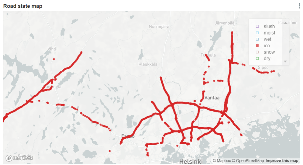
The past winter freezing rain occurred a number of times in Helsinki, Finland. By using RoadCloud’s fleet based hyperlocal road weather data, the Helsinki winter maintenance team could in real-time see the sudden change in road state, allowing them to react quickly and put in necessary actions to keep the roads safe.
As the RoadCloud fleet of commercial vehicles are constantly on the move, the change in road state and friction can be noticed immediately. Mounted with an optical sensor, the icy road surface is detected continuously in any lightning and on any surface. Not even black ice is a problem for the optical sensor.
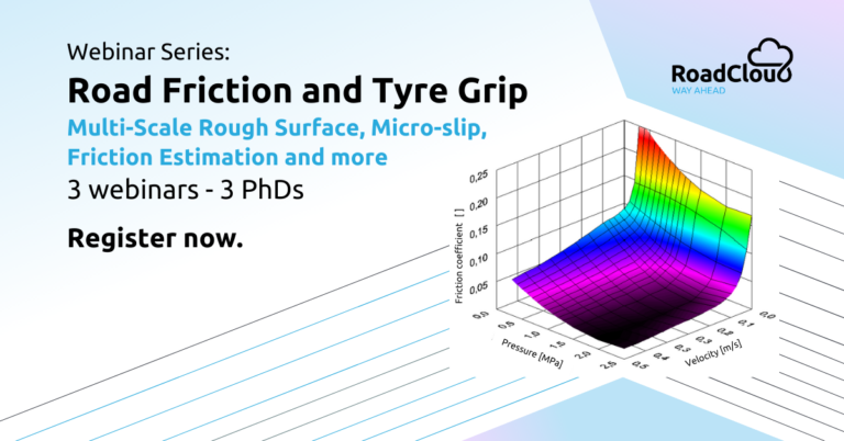
Join our unique webinar experience, where we walk through the essentials of Road Friction and Tyre Grip on a basic level in three parts. Presented by three of RoadCloud’s PhDs in the area, we warmly welcome you back to the classroom.